
Making Room for a Tiny Marsh Mouse

Why Is the Bay Delta So Important?
November 6, 2026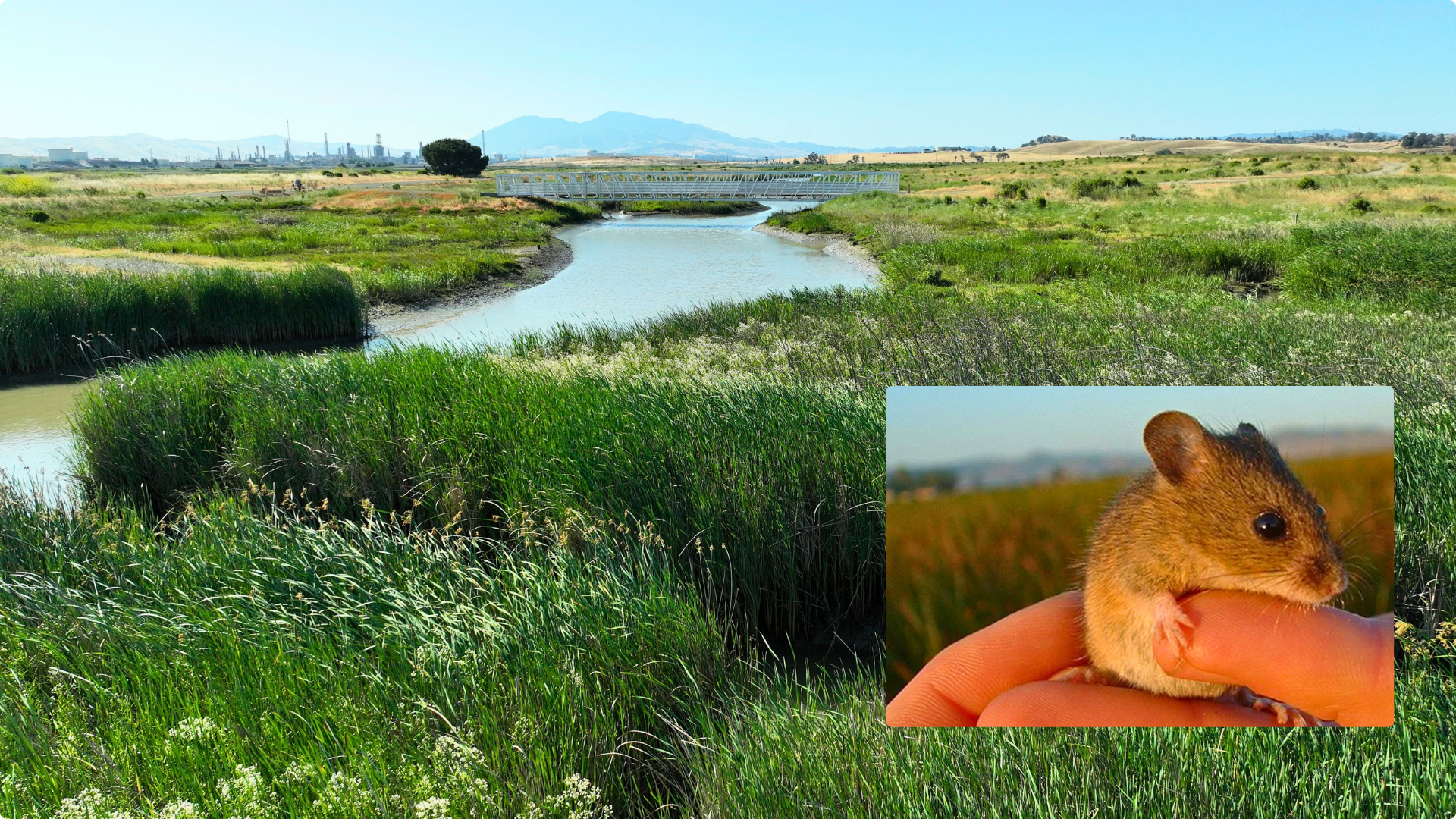
For a creature that weighs no more than two nickels, the salt marsh harvest mouse has some remarkable survival skills. It’s an excellent swimmer and can even drink seawater, something few mammals can do. Both abilities come in handy when your home is the tidal marshes of San Francisco Bay.
But the wetlands these mice depend on are disappearing. Over the past 150 years, more than 90 percent of the Bay’s historic tidal marshes have been diked, drained, or filled for agriculture and industry. Now, rising sea levels threaten what remains.
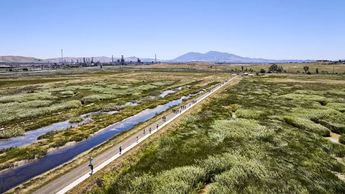
At Pacheco Marsh, just east of Martinez, John Muir Land Trust is helping bring the tides back to land long cut off from the Bay. From the main trail, visitors can watch newly excavated channels fill with brackish water from Suisun Bay. At high tide, water spills over the banks and spreads across a broad, gray-green expanse of pickleweed.
Beyond the pickleweed, the land slopes gently upward toward dry grasslands. In the distance, oil tankers pass beneath the Benicia-Martinez Bridge, and refinery towers rise along the industrial shoreline. Here, where Walnut Creek meets Suisun Bay, the returning tides are helping restore vital habitat for the salt marsh harvest mouse and other native wildlife.
A Mouse Built for the Marsh
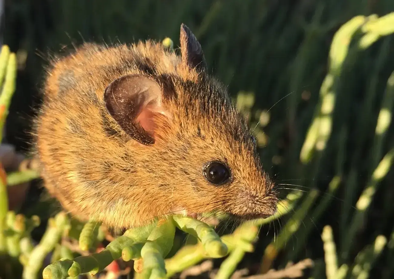
Weighing roughly 10 grams, about a third of an ounce, the salt marsh harvest mouse is only three inches long, not counting its tail. Its brown back and pale belly make it look so much like the common western harvest mouse that even biologists have to look closely to tell them apart.
The mouse spends most of its life hidden in dense marsh vegetation, especially pickleweed. This crunchy, salt-tolerant plant provides both food and shelter. The mouse also eats saltgrass, other marsh plants, and occasionally insects.
Found nowhere else in the world, the salt marsh harvest mouse has two subspecies, both native to the San Francisco Bay estuary. The northern subspecies lives in marshes around San Pablo and Suisun bays, including Pacheco Marsh.
With so much of its habitat lost, the salt marsh harvest mouse is now endangered under both federal and California law. California also designates it a fully protected species.
Staying Above the Tide
Twice a day, the tide moves through Pacheco Marsh, usually staying within its channels. But when exceptionally high tides or storm surges flood the marsh, the mice need to get above the water.
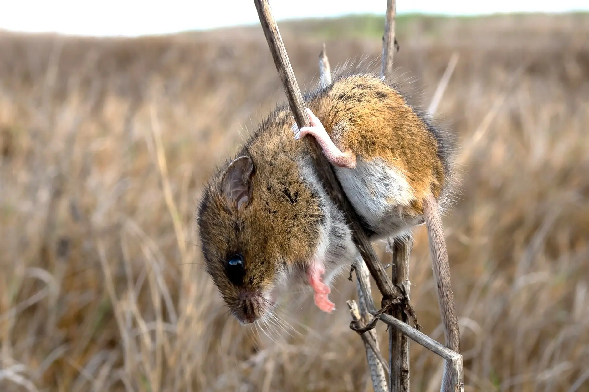
Most often, they climb. Research in nearby Suisun Marsh found that rather than moving inland, salt marsh harvest mice typically ride out high water among the upper stems of standing plants. When lower-growing pickleweed floods, taller vegetation such as gumplant can provide refuge.
But rising sea levels pose a much bigger challenge. California's 2024 sea-level rise guidance projects roughly 0.8 feet of rise statewide by 2050 and 1.6 to 3.1 feet by 2100, with higher levels possible.
As sea levels rise, tidal marshes need room to move inland. Where wetlands border open, gently sloping land, marsh vegetation can gradually establish itself at higher elevations. But where levees, roads, or development block the way, the marsh can become trapped between rising water and barriers that prevent it from moving.
Scientists call this coastal squeeze. Over time, the available marsh habitat shrinks, leaving less room for wildlife, including the salt marsh harvest mouse.
Protecting the land along a marsh's upper edge gives the entire wetland a better chance to adapt.
Room to retreat
What happens to a tidal marsh as sea levels rise? Compare a marsh with a natural slope to higher ground with one bordered by a levee.
Marsh with a natural upland edge
Highest tides. The pickleweed goes under, so the mouse moves upslope into gumplant and grass.
Marsh walled by a levee
Highest tides. The pickleweed goes under, and the steep, bare levee offers no slope to climb. The mouse is left exposed.
- Low tide
- Natural edge: the marsh floor is dry and the mouse forages in the pickleweed. Levee: the same, but the marsh ends at a wall.
- High tide
- Both marshes: when the water spills onto the marsh floor, the mouse climbs the pickleweed stems.
- Highest tides (shown)
- Natural edge: the mouse moves upslope into gumplant and grass. Levee: there is no slope to climb, and the mouse is left exposed.
- Future sea level
- Natural edge: the marsh can shift uphill and the mouse still has dry ground. Levee: the pickleweed floods more often and the mouse has no higher ground to reach.
Making Room for the Future
For much of the 20th century, levees kept tidal waters out of Pacheco Marsh. The land was used to dispose of dredged sediment and served as a buffer for nearby industrial facilities.
Bringing the marsh back took more than two decades of land acquisition, fundraising, planning, and engineering. In October 2021, John Muir Land Trust and the Contra Costa County Flood Control and Water Conservation District breached the final levee, reconnecting the marsh to Suisun Bay.
Crews dug more than five miles of winding tidal channels and moved nearly 35,000 dump-truck loads of soil to reshape the land.
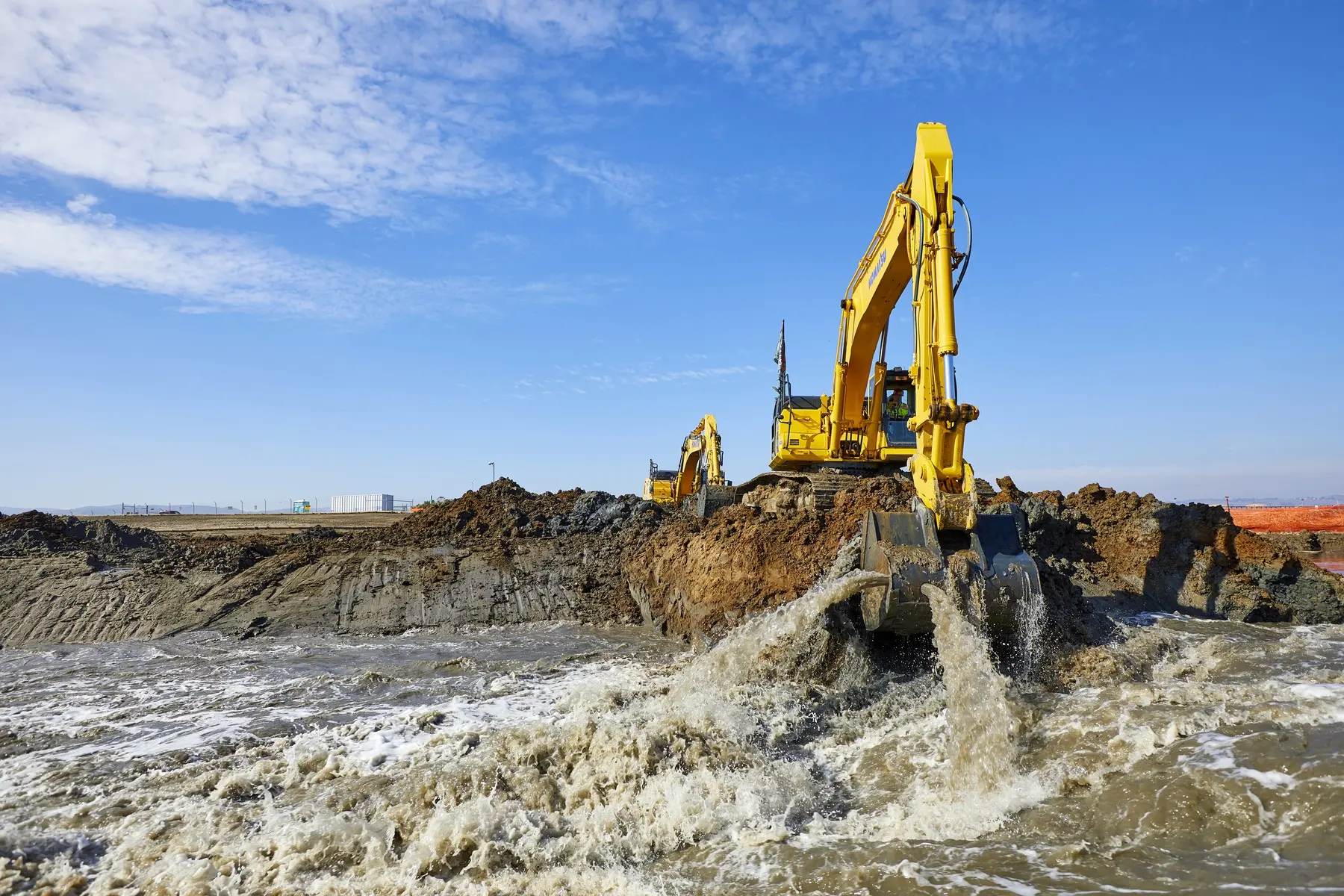
The goal wasn't simply to let water back in. It was to restore the natural features of a tidal marsh, with channels that carry water in and out and land that gradually rises from low-lying pickleweed to higher ground and dry grasslands. Higher vegetation gives mice places to shelter during extreme tides, while the rising ground gives marsh plants room to move inland as sea levels rise.
Today, Pacheco Marsh is once again connected to the tides. It's also open to the public, with trails and a kayak launch along a stretch of shoreline that was closed off for generations.
See the Marsh for Yourself
Pacheco Marsh is open daily from dawn to dusk at 2501 Waterfront Road in Martinez. Visitors can walk 2.4 miles of trails or use the non-motorized boat launch into Suisun Bay. The main parking lot is open from 9 a.m. to 5 p.m., with roadside parking available outside those hours. Dogs are not permitted, to protect sensitive marsh wildlife.
Don't expect to spot a salt marsh harvest mouse. They're mostly nocturnal and rarely venture into the open. But visit near high tide and you can watch water moving through the channels and spreading into the pickleweed. It's a chance to see a restored tidal marsh at work.
There's still plenty to do at Pacheco Marsh, and we'd love your help. Join us for an upcoming volunteer stewardship day.
Sources
- U.S. Fish and Wildlife Service, salt marsh harvest mouse species profile
- U.S. Fish and Wildlife Service, Recovery Plan for Tidal Marsh Ecosystems of Northern and Central California
- California Fish and Game Code §4700, fully protected mammals
- California Department of Pesticide Regulation, salt marsh harvest mouse fact sheet
- The Watershed Project, “What’s in Your Watershed? The Endangered Salt Marsh Harvest Mouse”
- California Ocean Protection Council, Sea Level Rise Guidance: 2024 Science and Policy Update
- U.S. Mint, coin specifications
- John Muir Land Trust, Pacheco Marsh
- John Muir Land Trust, “Dramatic Levee Breach Is Major Milestone in $24.5 Million Restoration of Pacheco Marsh and Lower Walnut Creek” (2021)
- U.S. Environmental Protection Agency, Lower Walnut Creek Restoration (archived page)